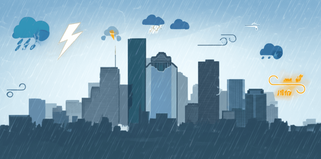
Weather Impact Alert: Houston Braces for Return of Heavy Rain and Storms This Wednesday – What You Need to Know
Houston residents are urged to prepare as a new wave of heavy rain and potentially severe storms is set to impact the area this Wednesday. This comprehensive guide details the latest timing, expected impacts, and crucial steps to ensure your safety.
Houston Braces for Return of Severe Weather: An Urgent Alert for Wednesday
Houston, a city no stranger to the whims of severe weather, is once again on high alert. Following a period of reprieve, the National Weather Service (NWS) has issued a critical advisory: heavy rain and storms are making a significant return to the Houston metropolitan area this Wednesday. This isn't just another rainy day; the forecast indicates conditions that could lead to substantial impacts, from flash flooding to potential severe thunderstorms. Understanding the latest timing and preparing proactively will be crucial for residents and businesses across the region.
As a dynamic urban hub with a unique relationship to its waterways and coastal proximity, Houston’s susceptibility to intense rainfall events is well-documented. Each weather alert serves as a vital reminder for vigilance and readiness. Let's break down the latest forecast details, potential impacts, and essential preparedness steps to navigate the upcoming conditions safely.
Decoding the Forecast: Timing and Intensity for Wednesday
The primary concern for Wednesday centers around a strong weather system expected to move through the area. Current NWS models suggest that the most significant activity will begin in the early morning hours, intensifying through the day and potentially lingering into the evening. While the exact timing can always shift slightly, the window of highest impact is clearly set for Wednesday.
- Rainfall Amounts: Forecasts currently indicate widespread totals of 2-4 inches, with localized areas potentially seeing significantly higher amounts, possibly exceeding 6 inches. These higher totals, especially over saturated ground, dramatically increase the risk of flash flooding.
- Flash Flood Threat: This is the most significant danger. Given that much of the region has seen recent rainfall, the ground’s ability to absorb additional water is diminished. Even moderate rainfall rates can quickly lead to street flooding, making many roadways impassable.
- Severe Storm Potential: Beyond the heavy rain, there’s an elevated risk of severe thunderstorms. This includes threats of strong, damaging winds, large hail, and even isolated tornado activity. Residents should stay alert for sudden changes in weather conditions and be prepared to take shelter.
- Impacted Areas: The entire Houston metro area is under threat, including surrounding counties. Areas along rivers and bayous, as well as low-lying neighborhoods and underpasses, are particularly vulnerable to rapid inundation.
It's vital to remember that weather forecasts are dynamic. Staying connected to official NWS updates, local news channels, and trusted weather apps will provide the most current and accurate information as the system approaches and evolves.
Why Houston Floods: A City's Unique Challenge
Understanding why Houston is so prone to flooding is key to appreciating the seriousness of these alerts. It's a combination of geography, rapid urbanization, and climate factors:
- Flat Topography: Houston sits on a very flat coastal plain. This means water drains slowly, and even small amounts of elevation change can determine whether an area floods.
- Proximity to the Gulf: Being so close to the Gulf of Mexico means a constant supply of warm, moist air, which fuels intense rainfall events. When tropical systems or slow-moving fronts interact with this moisture, the results can be catastrophic.
- Urbanization and Impermeable Surfaces: The rapid growth of Houston has led to vast areas being covered by concrete, asphalt, and rooftops. These impermeable surfaces prevent rainwater from soaking into the ground, instead directing it into storm drains, bayous, and streets, quickly overwhelming drainage systems.
- Bayou System: While Houston’s network of bayous is designed to carry water away, their capacity can be quickly exceeded during heavy downpours, leading to overflow into adjacent neighborhoods. Ongoing efforts to widen and deepen these channels are underway, but it’s a long-term process.
- Aging Infrastructure: Like many older cities, parts of Houston's drainage infrastructure are aging and may not be equipped to handle the intensity of modern rainfall events, which are becoming more frequent and severe due to changing climate patterns.
Beyond the Rainfall: Broader Impacts on Daily Life
When heavy rain and storms hit Houston, the effects ripple through daily life. Anticipating these disruptions can help you plan accordingly:
- Commuting Chaos: Expect significant delays and potential road closures. Flash flooding can make underpasses and low-lying roads impassable in minutes. Commuters are advised to adjust their schedules, work from home if possible, or take alternative routes and allow extra time. Never drive through standing water – the depth is often deceiving, and hidden hazards can be present.
- School Disruptions: Many school districts in the Houston area may announce delays or closures if conditions are severe enough to ensure student and staff safety. Parents should monitor school communications closely.
- Business Operations: Businesses may need to consider flexible work arrangements for employees or adjust operating hours. Ensuring business continuity plans are in place, especially for critical services, is paramount.
- Power Outages: Strong winds, lightning, and saturated ground can lead to power outages. Have backup power for essential devices and know how to report outages to your utility provider.
Your Preparedness Checklist: Staying Safe When Storms Hit
Proactive measures are your best defense against severe weather. Here’s a comprehensive checklist to help you prepare for Wednesday’s storms:
At Home:
- Clear Drains and Gutters: Ensure all gutters and storm drains around your property are free of leaves and debris. A clear path for water flow can prevent localized flooding around your home.
- Secure Outdoor Items: Bring in or tie down anything that could be blown away by strong winds, such as patio furniture, garbage cans, and trampolines.
- Elevate Valuables: If your home is in a flood-prone area, move important documents, electronics, and valuables to higher floors or elevated positions.
- Emergency Kit Essentials: Assemble a kit with at least three days’ worth of non-perishable food and water (one gallon per person per day). Include a battery-powered or hand-crank radio, flashlights, extra batteries, a first-aid kit, whistle, medications, and copies of important documents.
- Charge Devices: Fully charge all cell phones, laptops, and portable power banks before the storms hit to ensure communication capabilities if power is lost.
On the Road:
- "Turn Around, Don't Drown": This mantra cannot be stressed enough. Never attempt to drive or walk through flooded streets or rapidly moving water. Just six inches of water can stall a car, and 12 inches can sweep it away.
- Check Road Conditions: Use local traffic apps and official sources (like Houston TranStar) to check road closures and conditions before venturing out.
- Vehicle Readiness: Ensure your tires are properly inflated and have good tread. Check fluid levels. While you shouldn’t drive through water, a well-maintained vehicle is always safer.
Communication and Information:
- Stay Informed: Rely on official sources. Tune into local news channels, download weather apps that provide NWS alerts, and consider investing in a NOAA Weather Radio.
- Understand Alerts: Know the difference between a “Flood Watch” (conditions are favorable for flooding), “Flash Flood Warning” (flash flooding is occurring or imminent), and “Severe Thunderstorm Warning” (a severe storm is occurring or imminent). Take warnings seriously.
- Family Communication Plan: Discuss with family members how you will communicate if separated and what to do in case of an emergency. Designate an out-of-state contact for everyone to check in with.
Lessons Learned: Houston's History with Water
Houston's history is inextricably linked to water. From Tropical Storm Allison in 2001 to Hurricane Harvey in 2017 and Tropical Storm Imelda in 2019, the city has faced numerous devastating flood events. Each of these events, while tragic, has also served as a profound lesson in resilience and the critical importance of preparedness. Harvey, for example, dropped over 60 inches of rain in some areas, leading to unprecedented flooding and widespread displacement. Imelda, though less intense as a tropical storm, still brought significant flooding due to its slow movement over already saturated ground. These past experiences underscore that even seemingly minor systems can pose a major threat if conditions are right.
The city and its residents have continually adapted, investing in infrastructure projects, developing more sophisticated warning systems, and fostering a culture of community readiness. However, the sheer scale and frequency of these events mean that individual preparedness remains the cornerstone of effective disaster response. We've learned that water respects no boundaries, and being ready means understanding your personal risk and having a plan in place.
The Role of Technology in Weather Monitoring and Response
In recent years, technology has revolutionized how we monitor and respond to severe weather. For Houston, these advancements are particularly crucial:
- Enhanced Forecasting Models: Sophisticated computer models, constantly updated with real-time data from satellites, radar, and weather stations, provide increasingly accurate and timely forecasts, allowing for better lead times on alerts.
- Real-time Flood Sensors: The region utilizes networks of sensors in bayous and major waterways that provide real-time data on water levels, helping authorities monitor potential overflow points and issue targeted warnings.
- Wireless Emergency Alerts (WEA): Your smartphone can receive emergency alerts directly from the NWS or local authorities, even if cell service is spotty. Ensure these alerts are enabled on your device.
- Social Media as an Information Hub: While caution is advised to avoid misinformation, official city accounts, NWS Houston, and local news outlets often provide instant updates and critical information via social media platforms.
These technological tools, when used effectively, empower both authorities and individuals to make informed decisions that can save lives and property.
Community Resources and Support
During and after a severe weather event, knowing where to find help is vital. Here are some key resources:
- City of Houston Emergency Information: The official website of the City of Houston and Harris County Office of Homeland Security & Emergency Management (HCOHSEM) are primary sources for emergency declarations, shelter information, and public advisories.
- Utility Companies: Keep the contact information for your electricity (e.g., CenterPoint Energy) and gas providers handy to report outages or gas leaks safely.
- Local News Outlets: Traditional media – television, radio, and their online counterparts – provide continuous coverage, interviews with officials, and on-the-ground reports.
- Non-Profits and Volunteer Organizations: Organizations like the American Red Cross and local community groups often play a crucial role in providing immediate relief, shelter, and long-term recovery assistance.
The strength of Houston often shines brightest during times of adversity, with neighbors helping neighbors and communities coming together. Don’t hesitate to seek help if you need it, and always offer assistance safely if you are able.
Navigating the Aftermath: What to Do Post-Storm (Briefly)
While the focus is currently on preparation, it’s good to have a brief understanding of immediate post-storm steps:
- Assess Damage Safely: Wait until conditions are safe before inspecting your home or property. Be wary of downed power lines, gas leaks, and structural damage.
- Report Outages: Report any power outages to your utility provider.
- Avoid Contaminated Water: Stay away from floodwaters, which can be contaminated with sewage, chemicals, and hidden debris.
- Check on Neighbors: If safe to do so, check on elderly neighbors or those who may need assistance.
A Broader Perspective: Climate Change and Extreme Weather
It’s worth briefly noting that the increased frequency and intensity of severe weather events, like the heavy rainfall Houston is experiencing, are consistent with broader global climate trends. Scientific consensus suggests that a warming planet leads to more moisture in the atmosphere, which can translate into more extreme precipitation events. For coastal cities like Houston, this means a need for continued investment in resilient infrastructure and adaptive urban planning to mitigate future risks. While the immediate focus is on Wednesday, understanding the larger context helps inform long-term strategies for living safely in a changing climate.
Staying Informed with Trusted Sources
As Wednesday approaches, your most valuable tool will be accurate, up-to-the-minute information. Bookmark official NWS Houston pages, enable emergency alerts on your phone, and follow local news sources that have a strong track record of reliable weather reporting. For continuous updates on local news, emergency preparedness, and other vital information, remember to check our blog frequently, or dive into our dedicated News category for similar insights.
Conclusion: Vigilance is Key for Houston Residents
Wednesday is set to be a challenging day for Houston. The combination of heavy rainfall potential, flash flooding risk, and possible severe thunderstorms demands your full attention and preparedness. Take the time today to review your family’s emergency plan, secure your property, and ensure you have multiple ways to receive critical weather alerts. Stay off the roads if conditions deteriorate, and prioritize safety above all else. By working together and staying informed, the Houston community can navigate this latest weather challenge with resilience and minimal disruption.
Comments
Loading comments...